II. The Geography of North China
This section will dwell specifically on the geography of North China. Everything in our discussion of Daoism and the history behind it will take place within this region. Familiarity with the place names I present here will help immensely when describing historical events.
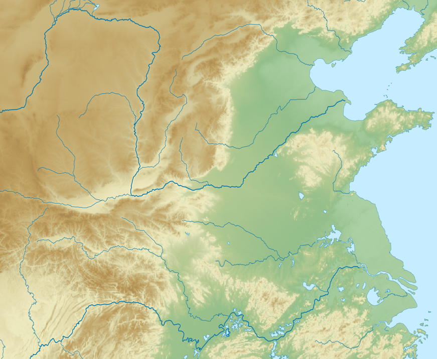
North China Topographic Map
I want to start with this blank map and proceed to fill in the names of the rivers and mountains which will be used in later discussions.
Major Rivers
Yangzi River
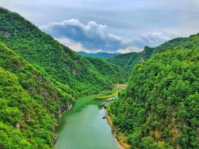
Two of the world's longest rivers run through North China. In the south is the Yangzi River (Wade-Giles Yangtze, pinyin Chang Jiang, 長江). The Chinese name for this river literally means "Long River".
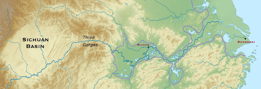
Yangzi Valley. Prehistoric wetlands outlined in lilac. Modern cities in dark red.
This river leaves the Himalayas and crosses through Sichuan (Wade Giles Szechwan,, 四川, "Four Rivers") The river then enters the Three Gorges, exiting into low lying country where it forms extensive lakes and marshes. Wild rice grew in these marshes, and rice was domesticated somewhere in the central portion of the lower Yangzi valley around 7000 BCE, Finally the Yangzi enters the East China Sea north of present day Shanghai, on the southern edge of the North China plain.
While I will not have much to say specifically about the Yangzi valley in our discussion of Daoism, it will always be in the background. The cultural influences of the southern regions on North China are significant, even if not obvious. Lao Zi may have come from the Southern kingdom of Chu.
Yellow River
The other large river of north China is the Yellow River (Huang He, 黃河).

Yellow River through the Loess Plateau and the North China Plain
An aside concerning the names of rivers. In the Yangzi watershed other rivers are named jiang (江). In North China other rivers are named he (河). And we have seen a third name for river in Si Chuan, chuan (川)。 These different names for the same thing suggests that the original peoples of central China spoke different languages from the north Chinese. Other hints of that possibility are found in the limited literature that came from these regions in the Zhou dynasty.
The Yellow River first flows north out of the mountains of northern Tibet. It then turns east, carving a canyon like a snake through the Loess Plateau. This plateau, at 4000 feet above sea level, is an accumulation of millions of years of sand and silt blown in from the north and west. The river picks up a lot of silt as it flows through the plateau, turning its characteristic yellow in the process.
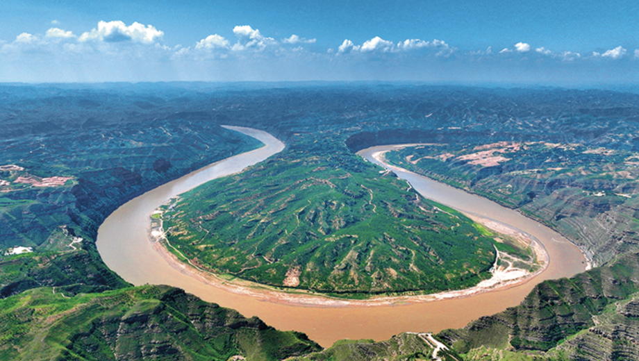
Upper Yellow River and Loess Plateau
The River then exits the plateau and crosses a series of old rift valleys. These valleys, now containing the Wei and Fen Rivers, are relatively flat owing to the silt deposited by the Yellow River. The River then takes a precipitous bend east through the mountains at Sanmenxia (三門峽;Three Gate Gorge), exiting onto the North China Plain at about 400 feet above sea level.
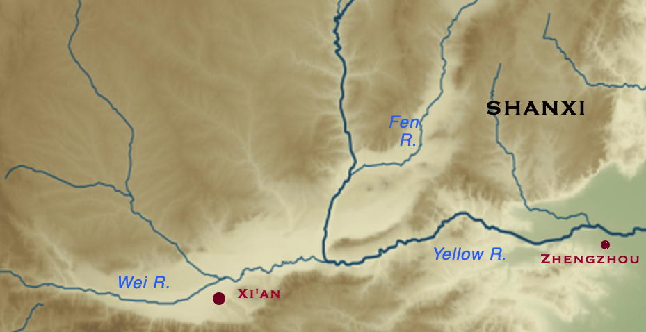
Middle Yellow River course through the Fen and Wei Rift valleys and the Three Gate Gorge
Yellow River below Sanmenxia (Three Gate Gorge)
The North China Plain is called an alluvial plain as its surface is entirely composed of silt washed down from the Loess Plateau. It is very similar to the alluvial plain created by the Mississippi River in Arkansas and Louisiana. In each case the river deposits so much silt that it forms natural levees. In the process the river bed becomes elevated; in the case of the Yellow River the river bed may be as much as 30 feet higher than the surrounding countryside. This sort of situation can and has led to disastrous flooding when the natural levees are breached. Historically the River has changed course after such floods. The map below shows the different courses of the lower Yellow River over the last three millenia.
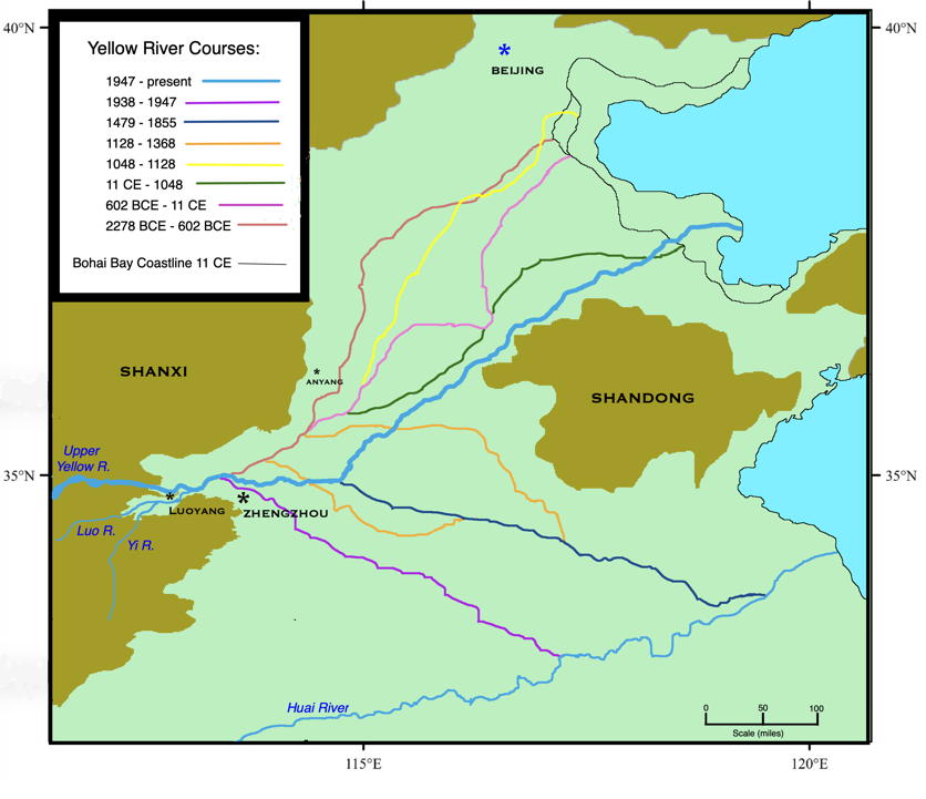
Historical changes in the course of the lower Yellow River
The last map also shows two sets of mountains bordering the North China Plain. Their names, Shandong (山東, “Eastern Mountains") and ShanXi (山西, "western mountains), reflect the fact that a civilization arose between them.
Because of its natural levees the Yellow River has very few tributaries entering it from the North China plain. The only exceptions are the Luo and Qin Rivers. Both join the Yellow River just after it leaves the Three Gate Gorge, and before it has descended completely into the North China Plain.
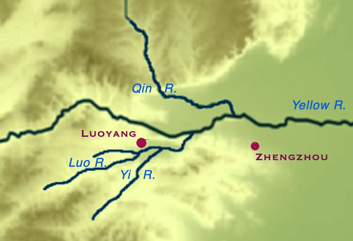
Luo and Yi rivers. The distance between modern day Luoyang and Zhengzhou is 90 miles
In the middle and lower Yellow River valley millet had been domesticated by 6000 BCE. Millet would be the chief grain of this region for some time; wheat would arrive much later from the west (around 2500 BCE). Soybeans were eaten in the lower Yellow River valley by 7000 BCE, although it is hard to say when the soybean was domesticated. Pigs were also present in early human communities in the Yellow River valley by 7000 BCE; they were probably domesticated locally.
Ancient China climate
The climate in China was warmer and more humid than now until 2000 BCE. Over the next thousand years (until 1000 BCE) there was a decrease in the mean temperature of about 2 degrees Celsius. Along with this decrease in average temperature came a weakening of the summer monsoon rains. Thus the subtropical forests which once ranged throughout the Yellow River valley retreated south, and regions in the northwest interior of China changed from forest to grassland.
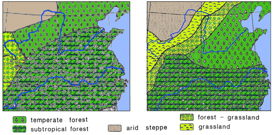
Vegetation Zones in China, 4000 BCE (left) and present day (right)
In prehistoric times the North China plain was largely forested, the ony exceptions being areas of alluvial silt left by floods. There were likely large numbers of alluvial lakes scattered throughout the plain, some new from recent flooding, some old and in the processs of evolving into marshland. Native herds of water deer and water buffalo would have been found. Deer, elk and the furry Sumatran rhinoceros lived on drier land. Elephants may have lived as far north as the Yellow Rifer, but probably were only common in the Yangzi valley. Carnivores included leopards and tigers, foxes and wolves.